Turbomaps Update: Points, pencils, and documentation
There’s been many improvements to the annotation tools in Turbomaps in the last few months.
Easier point editing
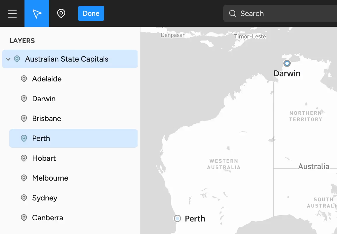
Point layers can contain multiple points with individual names. Previously, you would need to find the individual point on the map to edit it. This is now much easier—individual points are now shown in the sidebar and can be edited directly.

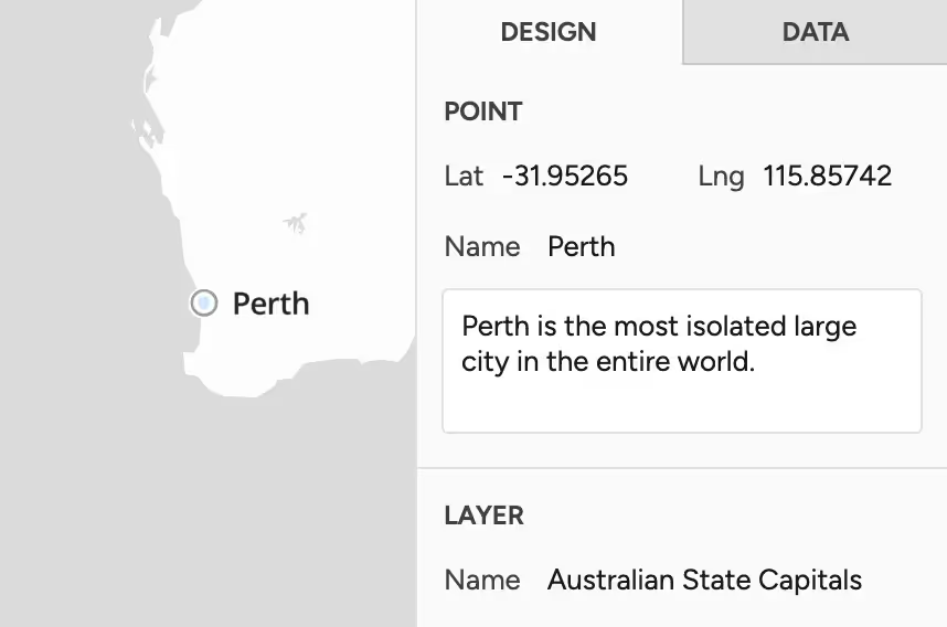
Additionally, you can now add notes to individual points—useful if you want to add context to a particular location. Notes aren’t currently viewable on public facing maps, but options for this will be added in the near future.

Individual points within all layer types can now be multi-selected using ctrl+click. You can move these points all at once, or update names & notes in bulk.
Improved pencil tool
The pencil tool now draws much smoother lines. These are created as polygon layers, so they scale when you change the zoom level of the map.

Product documentation
Need help with Turbomaps? Product documentation is now available on the website. This documentation explains features in depth and outlines the current limitations of the software.
Other changes
- The ruler & map scale now display measurements in either metric or United States customary units.
- The opacity of the basemap can now be adjusted.
- You can quickly zoom to your current location in both the editor and public facing maps.
- The app font has been changed to be easier to read.